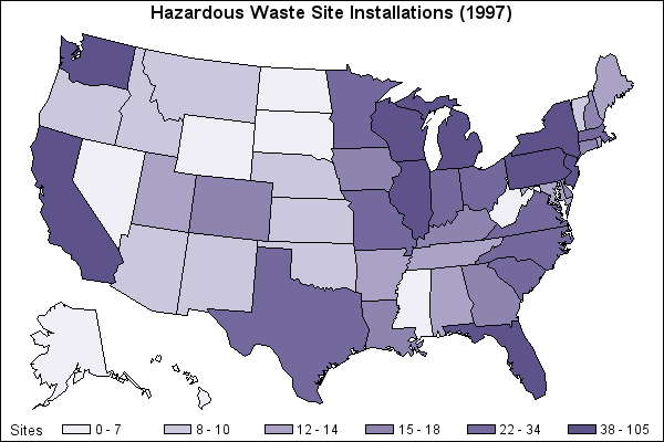
Standardized choropleth maps are a way of representing the calculated population of an area per square mile. This is so the distributions can be compared. The shading on this map shows the relative distribution in each state.
http://support.sas.com/sassamples/graphgallery/PROC_GMAP.html
No comments:
Post a Comment